| |
Canku Ota
|
|
|
(Many Paths)
|
||
|
An Online Newsletter
Celebrating Native America
|
||
|
December 2017 - Volume
15 Number 12
|
||
|
|
||
|
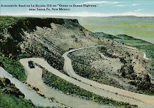
Pueblo Bars Access
To Historic La Bajada Area
|
||
|
by Tripp Stelnicki |
The New Mexican
|
||
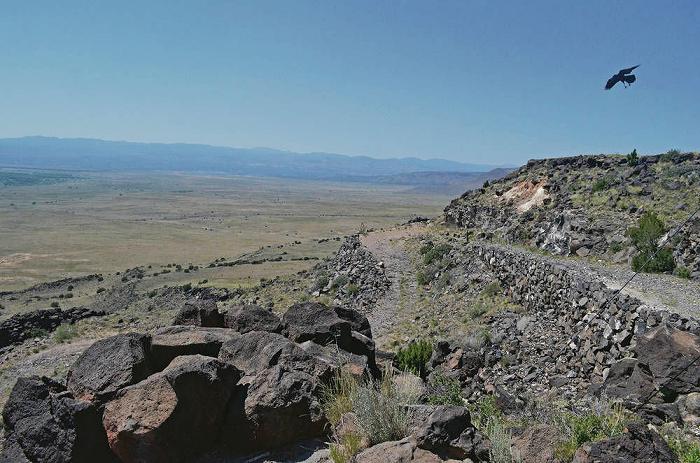
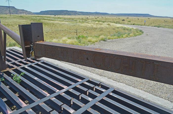
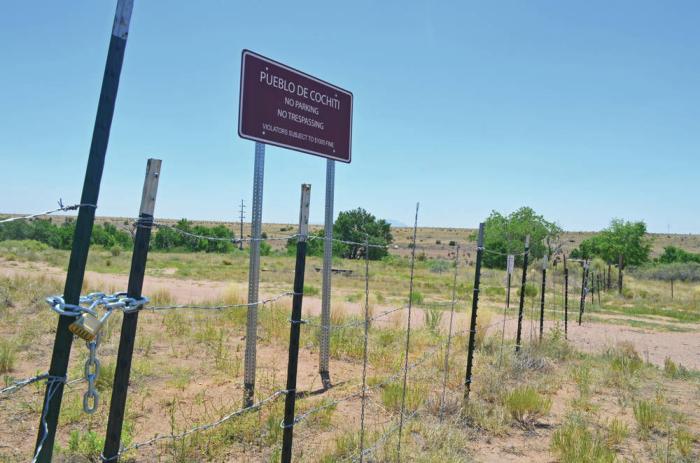
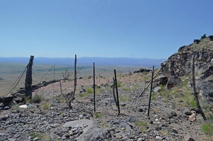
Cochiti Pueblo has shut access to La Bajada, the cultural and geological landmark, saying it needs to protect the area from further visitor abuse. The steep escarpment south of Santa Fe is now inaccessible to hikers, historians and others — even a nearby villager who says the small community's source of water has been fenced off. At the base of the 600-foot basalt cliff, blockades erected by the pueblo threaten trespassers with hefty fines. A barbed wire fence has been erected across a road bordering the traditional village of La Bajada. An unmarked, waist-high barbed wire fence blocks the road at the top of the mesa.
Cochiti Pueblo's closure of the area has upset nearby residents and others who visited the area to hike or take photographs, thinking the land was public. "We're trying to find the money for lawyers," said Alonzo Gallegos, a lifelong resident of La Bajada village. "But it's going to be a long process. They're a sovereign nation. What can we do?"
Jacob Pecos, the pueblo's natural resources director, said the tribe wants to protect its borders from the deterioration caused by visitors and time. "We've lost so much," Pecos said. "The pueblo is trying to hang onto and protect everything it's got left. "It's been abused for a long time," he said of the escarpment area. "There are a lot of good people, but there are also the ones who do damage. … We want to protect our land for our future generations." Pecos said he expects the area to remain closed indefinitely but that it is possible permits might be issued for special uses. The area includes a part of El Camino Real, the Spanish colonial road linking Mexico City and Santa Fe, as well as an abandoned stretch of Route 66, the iconic highway from Chicago to Los Angeles. The Route 66 roadway and surrounding artifacts were listed on the National Register of Historic Places in 2005.
Andy House, a former president of the Route 66 Association, has hiked the area many times and said he doesn't understand what Cochiti Pueblo is trying to protect against. "It's just landscape," House said. "There's nothing to steal. It's just people hiking." Keith Kofford, a member of the Albuquerque-based Route 66 Association, used to visit the site frequently to hike, take photographs and search for long-lost signage. "I just am floored and flabbergasted they would shut the thing down without a word of warning," Kofford said. Pecos said the pueblo will respond to association members who have sought information about the closures, but he added that whether visitors want to hike, hang glide or simply explore the space, the pueblo's primary concern is its resources. "I guess this has some history and meaning to those people, as well, but nobody more than the pueblo," he said.
Gallegos said the barbed wire fence on his street in La Bajada village appeared this year. On the other side of that fence, he said, is the source of the village water. La Bajada's water system is gravity-fed. Residents recently received a key that allows them to pass the fence and access the source of their water, Gallegos said. That access, he said, came with a warning from the pueblo not to venture beyond strictly defined parameters. "It's sad to see," Gallegos said. "This road's been open since the 1600s, and then they block us off without even coming to us or talking about it. They just did it." A La Bajada community meeting is scheduled for July 15 to discuss the village's rights of way. A memo posted on signs and front gates around the village says the meeting will take place "pending agreements with the Pueblo de Cochiti." Pecos said there are no rights of way, only a "prescriptive use" that occurred in the past. But, he said, "We're currently working with villagers right now toward perfecting some kind of right of way. We're not prohibiting them; that's not the case." Past users of the closed area say they were under the impression the land was public and part of the Santa Fe National Forest. The pueblo said it obtained the land from the forest in 1984. A map of parcels kept by the Santa Fe County Assessor's Office shows forest land ends at roughly the midpoint of the La Bajada escarpment. Cochiti Pueblo land, down and to the west, begins at that point. Part of the switchback trail at the top of the mesa that has been blocked by a barbed wire fence is within the forest parcel, not the pueblo's. Pecos said the fence belongs to the Forest Service and keeps cattle from coming down the road. A forest spokeswoman said she was not sure the fence belonged to the Forest Service and would be surprised if the pueblo had erected a fence on forest property. Several times in recent years, advocates have pushed to obtain national monument status for the La Bajada escarpment and adjacent mesa. A National Park Service webpage for La Bajada Mesa encourages visitors to drive the rocky rutted mesa road to the edge of the escarpment but cautions against rattlesnakes, off-road motoring and traveling down the escarpment slope. The road has eroded and is rough, the park service warns. And halfway down, it says, the land belongs to Cochiti, where permission is needed to enter. |
||||||||||
|
|
|
|
||
|
|
||
|
|
||
|
|
||
| Canku Ota is a free Newsletter celebrating Native America, its traditions and accomplishments . We do not provide subscriber or visitor names to anyone. Some articles presented in Canku Ota may contain copyright material. We have received appropriate permissions for republishing any articles. Material appearing here is distributed without profit or monetary gain to those who have expressed an interest. This is in accordance with Title 17 U.S.C. Section 107. | ||
|
Canku Ota is a copyright ©
2000 - 2017 of Vicki Williams Barry and Paul Barry.
|
||
| |
|
|
|
The "Canku
Ota - A Newsletter Celebrating Native America" web site and
its design is the
|
||
|
Copyright ©
1999 - 2017 of Paul C. Barry.
|
||
|
All Rights Reserved.
|
||